
Valdepeñas topographic map
Click on the map to display elevation.
About this map
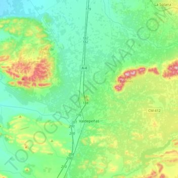
Name: Valdepeñas topographic map, elevation, terrain.
Location: Valdepeñas, Ciudad Real, Castile-La Mancha, Spain (38.66991 -3.54927 38.94854 -3.24387)
Average elevation: 730 m
Minimum elevation: 645 m
Maximum elevation: 1,004 m
Other topographic maps
Click on a map to view its topography, its elevation and its terrain.