Geolocate

Las Vega topographic map

Click on the map to display elevation.

About this map

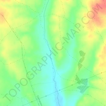
Name: Las Vega topographic map, elevation, terrain.

Location: Las Vega, Camarena, Toledo, Castile-La Mancha, 45180, Spain (40.09579 -4.16743 40.11579 -4.14743)

Average elevation: 596 m

Minimum elevation: 571 m

Maximum elevation: 628 m

Gear up for your next adventure:

🥾Mountaineering Boots - Supportive boots for climbing and high-altitude hiking
❄️Traction Ice Cleats - Slip-on spikes for icy trails and winter hiking
🦟Insect Repellent - Keep mosquitoes and black flies away in wooded areas
🧢Hiking Hat - Sun-protective and breathable hats for long treks
🛁Quick-Dry Microfiber Towel - Space-saving towel that dries rapidly on the move

As an Amazon Associate, this site earns from qualifying purchases at no extra cost to you.