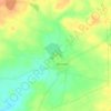
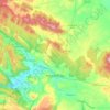
Caraquiz topographic map
Click on the map to display elevation.
About this map
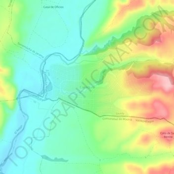
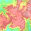
Name: Caraquiz topographic map, elevation, terrain.
Location: Caraquiz, Uceda, Guadalajara, Castile-La Mancha, 28170, Spain (40.77140 -3.50916 40.81140 -3.46916)
Average elevation: 713 m
Minimum elevation: 652 m
Maximum elevation: 822 m
Other topographic maps
Click on a map to view its topography, its elevation and its terrain.

Seseña
The municipality spans across a total area of 71.41 km2. To the north, the municipality borders the Madrid region. The northern part of Seseña reaches the highest altitude in the municipality, at around 684 metres above mean sea level, while the southern end close to the Jarama and Tagus rivers lies at around…
Average elevation: 592 m

Santa Cruz de la Zarza
It is located in the northeast region of the province of Toledo, on the border between Toledo, Madrid and Cuenca. It is located 85, 83, and 101 km from the provincial capitals, respectively. Its length is 264.54 km2, and its altitude is 790 m. Bordered by the municipalities of Villamanrique de Tajo and…
Average elevation: 724 m
Campo de Criptana
The 13th century beginnings of the urban center were situated around a fortified position in the Cerro de La Paz, which served as a defensive outpost of the Castillo de Criptana. The topographical features of the area determined the formation of the city and its subsequent expansion into the plain to the south.
Average elevation: 658 m



Valdeaveruelo
The terrain is rolling in the north and flat in the south, with elevations ranging from 852 metres in the north (Torrecabrón Hill) to 770 metres in the south. The town itself lies at an elevation of 740 metres above sea level.
Average elevation: 764 m

Guadalajara
Chosen as settlement on the basis of defensive purposes, the historic urban core of the city lies on a small elevation near the left-bank of the Henares River, also enclosed to the East and West by two small ditches corresponding to two watercourses, Alamín [es] and San Antonio, respectively, forming a narrow…
Average elevation: 802 m

Sonseca
The municipality covers an area of 60.27 km². The altitude in the northern part is around 754 m above sea level, with slight variations near the Montes de Toledo, where the land gently rises to the south. Sonseca consists of two main settlements: the town of Sonseca and the hamlet of Casalgordo, located…
Average elevation: 788 m





Cuenca
The climate of Cuenca is the typical hot-summer Mediterranean climate of Spain's "Meseta" (inner plateau). Winters are relatively cold, but summers are quite hot during the day with occasional cool nights. Spring and autumn seasons are short, with pleasant temperatures during the day but with rather cold…
Average elevation: 1,124 m
Albacete
Albacete is located in the South-East of the Iberian Peninsula, in the plains of La Mancha (part of the Inner Plateau), at an elevation of about 686 metres (2,251 feet).
Average elevation: 786 m



Cuenca
The climate of Cuenca is the typical hot-summer Mediterranean climate of Spain's "Meseta" (inner plateau). Winters are relatively cold, but summers are quite hot during the day with occasional cool nights. Spring and autumn seasons are short, with pleasant temperatures during the day but with rather cold…
Average elevation: 1,124 m



Cuenca
The climate of Cuenca is the typical hot-summer Mediterranean climate of Spain's "Meseta" (inner plateau). Winters are relatively cold, but summers are quite hot during the day with occasional cool nights. Spring and autumn seasons are short, with pleasant temperatures during the day but with rather cold…
Average elevation: 1,124 m
Guadalajara
Chosen as settlement on the basis of defensive purposes, the historic urban core of the city lies on a small elevation near the left-bank of the Henares River, also enclosed to the East and West by two small ditches corresponding to two watercourses, Alamín [es] and San Antonio, respectively, forming a narrow…
Average elevation: 802 m
Ciudad Real
The province of Ciudad Real is located in central Spain and is the third largest province in the country with an area of 19,813 km2 (7,650 sq mi). To the north lies the Province of Toledo, to the northeast the Province of Cuenca, to the east the Province of Albacete, to the south lie the Provinces of Córdoba…
Average elevation: 683 m


Ciudad Real
The city has a cold semi-arid climate (Köppen: BSk), with cool winters (due to its altitude) and hot to very hot dry summers. Like many other cities of Castilla-La-Mancha, the precipitation is limited throughout the year. It has one of the highest annual temperature ranges in the Iberian Peninsula, exceeding…
Average elevation: 630 m

Cuenca
The climate of Cuenca is the typical hot-summer Mediterranean climate of Spain's "Meseta" (inner plateau). Winters are relatively cold, but summers are quite hot during the day with occasional cool nights. Spring and autumn seasons are short, with pleasant temperatures during the day but with rather cold…
Average elevation: 1,124 m




La Roda
The extensive municipal area features a flat terrain characteristic of the La Mancha Alta Albaceteña region. It is situated 716 meters (2349 feet) above sea level, with the southwestern edge of the municipality reaching higher elevations (over 850 meters, 2788 feet) near the Campo de Montiel.
Average elevation: 724 m
Molina de Aragón
Molina de Aragón has a warm-summer mediterranean climate (Köppen climate classification: Csb) with some semi-arid influences. Precipitation is irregular throughout the year, with most rainfall occurring during spring and autumn. Winters are cold for Spanish standards, with temperatures often below 0 °C (32…
Average elevation: 1,163 m