Geolocate

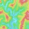
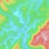
Cedar Rock topographic map

Click on the map to display elevation.

About this map

Name: Cedar Rock topographic map, elevation, terrain.

Location: Cedar Rock, Caldwell County, North Carolina, United States (35.92824 -81.46930 35.95372 -81.44637)

Average elevation: 429 m

Minimum elevation: 342 m

Maximum elevation: 612 m

Other topographic maps

Click on a map to view its topography, its elevation and its terrain.
Upton

United States > North Carolina > Caldwell County

Average elevation: 536 m

Globe

United States > North Carolina > Caldwell County

Average elevation: 489 m

Piney

United States > North Carolina > Caldwell County

Average elevation: 377 m

Globe

United States > North Carolina > Caldwell County

Average elevation: 489 m

Warrior

United States > North Carolina > Caldwell County

Average elevation: 431 m

Gear up for your next adventure:

🦶Anti-Blister Balm - Prevents friction and hotspots during long ascents
💡LED Camping Lantern - Illuminate your campsite with long-lasting lanterns
👟Leg Gaiters - Keep debris, mud, and snow out of your boots
🥽Outdoor Goggles - Protective eyewear for outdoor activities
🛏️Camping Sleeping Mat - Comfortable mats for sleeping outdoors

As an Amazon Associate, this site earns from qualifying purchases at no extra cost to you.