Geolocate

Upton topographic map

Click on the map to display elevation.

About this map

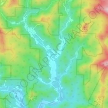
Name: Upton topographic map, elevation, terrain.

Location: Upton, Caldwell County, North Carolina, United States (36.05013 -81.71538 36.09013 -81.67538)

Average elevation: 536 m

Minimum elevation: 411 m

Maximum elevation: 781 m

Other topographic maps

Click on a map to view its topography, its elevation and its terrain.

Lenoir

United States > North Carolina > Caldwell County

Average elevation: 381 m

Lenoir

United States > North Carolina > Caldwell County

Average elevation: 381 m

Gear up for your next adventure:

🥾Light Trekking Boots - Supportive boots for multi-day treks
🧥Waterproof Pants - Keep dry during rainy hiking conditions
🛶Canoe Life Vest - Safety vest for water sports
🧣Evaporative Cooling Towel - Beat the heat during intense summer climbs
👖Convertible Hiking Pants - Zip-off legs to adapt to changing weather conditions

As an Amazon Associate, this site earns from qualifying purchases at no extra cost to you.