Geolocate

Su topographic map

Click on the map to display elevation.

Su

Su, belongs to the municipality of Riner, in the comarca of Solsonès, vegueria of Comarques Centrals (Catalonia). Su is situated at an elevation of 726 meters above sea level.

Wikipedia (CC-BY-SA 3.0)

About this map

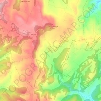
Name: Su topographic map, elevation, terrain.

Location: Su, Riner, Solsonès, Lleida, Catalonia, 25287, Spain (41.86838 1.54499 41.90838 1.58499)

Average elevation: 738 m

Minimum elevation: 602 m

Maximum elevation: 838 m

Other topographic maps

Click on a map to view its topography, its elevation and its terrain.

Odèn

Spain > Catalonia > Solsonès

Average elevation: 1,196 m

Solsona

Spain > Catalonia > Solsonès

Average elevation: 712 m

Lladurs

Spain > Catalonia > Solsonès

Average elevation: 869 m

la Coma i la Pedra

Spain > Catalonia > Solsonès

Average elevation: 1,538 m

Solsona

Spain > Catalonia > Solsonès

Average elevation: 712 m

la Coma i la Pedra

Spain > Catalonia > Solsonès

Average elevation: 1,538 m

Guixers

Spain > Catalonia > Solsonès

Average elevation: 1,309 m

Gear up for your next adventure:

🌡️Emergency Mylar Blankets - Compact thermal protection for unexpected nights outdoors
🔭Outdoor Binoculars - Lightweight binoculars for birdwatching and hiking
🔦LED Headtorch - Bright and durable light for night activities
🦌Outdoor Trail Camera - Monitor wildlife activity near your favorite spots
🧢Hiking Hat - Sun-protective and breathable hats for long treks

As an Amazon Associate, this site earns from qualifying purchases at no extra cost to you.