Geolocate

Cassola topographic map

Click on the map to display elevation.

About this map

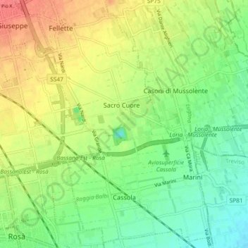
Name: Cassola topographic map, elevation, terrain.

Location: Cassola, Vicenza, Veneto, 36022, Italy (45.72306 11.74704 45.77158 11.81971)

Average elevation: 100 m

Minimum elevation: 75 m

Maximum elevation: 133 m

Other topographic maps

Click on a map to view its topography, its elevation and its terrain.

Arso

Italy > Veneto > Vicenza > Chiampo

Average elevation: 425 m

La Gusela

Italy > Veneto > Vicenza > Cismon del Grappa

Average elevation: 556 m

San Pietro

Italy > Veneto > Vicenza

Average elevation: 832 m

Axe

Italy > Veneto > Vicenza > Posina

Average elevation: 880 m

Villa di Fimon

Italy > Veneto > Vicenza > Fimon

Average elevation: 230 m

Rotz

Italy > Veneto > Vicenza > Gallio

Average elevation: 1,167 m

Sette

Italy > Veneto > Vicenza > San Vito di Leguzzano

Average elevation: 234 m

Staro

Italy > Veneto > Vicenza

Average elevation: 645 m

Troio

Italy > Veneto > Vicenza > Lusiana

Average elevation: 813 m

Frisoni

Italy > Veneto > Vicenza > Stoner

Average elevation: 1,096 m

Località Casoni

Italy > Veneto > Vicenza > Marano Vicentino

Average elevation: 154 m

Campanella

Italy > Veneto > Vicenza

Average elevation: 582 m

Fosse di Sopra

Italy > Veneto > Vicenza > Enego

Average elevation: 680 m

Clama

Italy > Veneto > Vicenza > Asiago > Clama

Average elevation: 1,055 m

Campedello

Italy > Veneto > Vicenza > Vicenza

Average elevation: 46 m

Valstagna

Italy > Veneto > Vicenza > Valstagna

Average elevation: 556 m

Gear up for your next adventure:

🧥Ultralight Puffy Jacket - Maximum warmth that packs down to the size of an orange
Camping Tent - Weather-resistant tents suitable for 2 to 6 people
🧦Thermal Socks - Warm socks for winter hiking or camping
🧼Travel Hand Sanitizer - Keep hands clean when water is scarce
🔋Lithium AA Batteries - Long-lasting power that performs in extreme cold

As an Amazon Associate, this site earns from qualifying purchases at no extra cost to you.