Geolocate

Bakersfield topographic map

Click on the map to display elevation.

About this map

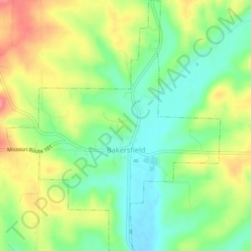
Name: Bakersfield topographic map, elevation, terrain.

Location: Bakersfield, Ozark County, Missouri, United States (36.51028 -92.16077 36.54076 -92.12843)

Average elevation: 244 m

Minimum elevation: 208 m

Maximum elevation: 291 m

Other topographic maps

Click on a map to view its topography, its elevation and its terrain.

Wasola

United States > Missouri > Ozark County

Average elevation: 361 m

Hardenville

United States > Missouri > Ozark County

Average elevation: 261 m

Isabella

United States > Missouri > Ozark County

Average elevation: 266 m

Dawt

United States > Missouri > Ozark County

Average elevation: 219 m

Tecumseh

United States > Missouri > Ozark County

Average elevation: 220 m

Gear up for your next adventure:

🕶️Polarized Sunglasses - Protect your eyes with durable polarized lenses
🦌Outdoor Trail Camera - Monitor wildlife activity near your favorite spots
🧴Outdoor Sunscreen - High SPF protection for high-altitude UV exposure
🧤Insulated Winter Gloves - Heavy-duty protection for sub-zero Canadian adventures
🗺️Topographic Maps - Detailed maps to explore trails, mountains, and wilderness areas

As an Amazon Associate, this site earns from qualifying purchases at no extra cost to you.