Geolocate

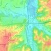
Ottawa County topographic map

Click on the map to display elevation.

About this map

Name: Ottawa County topographic map, elevation, terrain.

Location: Ottawa County, Kansas, United States (38.95784 -97.93012 39.30734 -97.37003)

Average elevation: 410 m

Minimum elevation: 356 m

Maximum elevation: 502 m

Other topographic maps

Click on a map to view its topography, its elevation and its terrain.
Warnock Lake

United States > Kansas > Atchison County > Atchison

Average elevation: 294 m

Mount Sunflower

United States > Kansas > Wallace County

Mount Sunflower, although not a true mountain, is the highest natural point in the U.S. state of Kansas. At 4,039 feet (1,231 m), it is 3,300 feet (1,010 m) above the state's topographic low point, which lies on the opposite side of the state. It is located between the communities of Kanorado and Weskan in…

Average elevation: 1,215 m
Tecumseh

United States > Kansas > Shawnee County

Average elevation: 279 m

Volland

United States > Kansas > Wabaunsee County

Average elevation: 387 m

Twin Butte

United States > Kansas > Logan County

Average elevation: 996 m

Bayard

United States > Kansas > Allen County

Average elevation: 321 m

Zarah

United States > Kansas > Johnson County > Shawnee

Average elevation: 268 m

Rolling Hills

United States > Kansas > Sedgwick County > Wichita

Average elevation: 408 m

Gear up for your next adventure:

🥾All-Terrain Hiking Boots - Versatile boots for varied hiking conditions
🗺️Topographic Maps - Detailed maps to explore trails, mountains, and wilderness areas
🚲Heavy Duty Bike Lock - Secure your bike at the trailhead or during stops
🛌Insulated Sleeping Pad - Critical thermal barrier between you and the cold ground
💡LED Headlamp - Hands-free illumination for night hiking and camping

As an Amazon Associate, this site earns from qualifying purchases at no extra cost to you.