Geolocate

Scram Lake topographic map

Click on the map to display elevation.

About this map

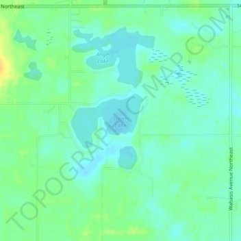
Name: Scram Lake topographic map, elevation, terrain.

Location: Scram Lake, Oakfield Township, Kent County, Michigan, United States (43.16042 -85.41658 43.16656 -85.40554)

Average elevation: 270 m

Minimum elevation: 261 m

Maximum elevation: 287 m

Other topographic maps

Click on a map to view its topography, its elevation and its terrain.

Pickerel Lake

United States > Michigan > Kent County

Average elevation: 268 m

Nelson Township

United States > Michigan > Kent County

Average elevation: 275 m

Oakfield Township

United States > Michigan > Kent County

Average elevation: 265 m

Byron Township

United States > Michigan > Kent County

Average elevation: 221 m

Kentwood

United States > Michigan > Kent County > Kentwood

Average elevation: 218 m

Sparta Township

United States > Michigan > Kent County

Average elevation: 246 m

Alaska

United States > Michigan > Kent County

Average elevation: 230 m

Alto

United States > Michigan > Kent County

Average elevation: 252 m

Ada

United States > Michigan > Kent County

Average elevation: 208 m

Ada Township

United States > Michigan > Kent County

Average elevation: 228 m

Gaines Township

United States > Michigan > Kent County

Average elevation: 243 m

Alton

United States > Michigan > Kent County > Vergennes Township

Average elevation: 254 m

Solon Township

United States > Michigan > Kent County

Average elevation: 263 m

Gear up for your next adventure:

🧴Sunscreen SPF - Broad-spectrum sunscreen for outdoor activities
🕶️Polarized Sunglasses - Protect your eyes with durable polarized lenses
🧳Compression Sacks - Maximize space in your backpack by shrinking gear
🧰Multitool Knife - Compact and versatile tool for outdoor use
🧴Waterproofing Spray - Restore the DWR coating on jackets and tents

As an Amazon Associate, this site earns from qualifying purchases at no extra cost to you.