Geolocate

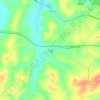
Clarke County topographic map

Click on the map to display elevation.

About this map

Name: Clarke County topographic map, elevation, terrain.

Location: Clarke County, Virginia, United States (38.97953 -78.15170 39.26448 -77.82815)

Average elevation: 200 m

Minimum elevation: 98 m

Maximum elevation: 586 m

Other topographic maps

Click on a map to view its topography, its elevation and its terrain.
Round Hill

United States > Virginia > Loudoun County

Average elevation: 177 m

Solsburg

United States > Virginia > Rockingham County > Elkton

Average elevation: 307 m

Newport News

United States > Virginia > Newport News

Average elevation: 4 m

Ingham

United States > Virginia > Page County

Average elevation: 361 m

Good

United States > Virginia > Frederick County

Average elevation: 356 m

Pinnacle

United States > Virginia > Frederick County

Average elevation: 646 m

Greenfields

United States > Virginia > Charlottesville

Average elevation: 136 m

Aldie

United States > Virginia > Loudoun County

Average elevation: 119 m

Belle View

United States > Virginia > Belle View

Average elevation: 21 m

Big Hill

United States > Virginia > Rockbridge County

Average elevation: 486 m

Green Spring

United States > Virginia > Frederick County

Average elevation: 245 m

Old Beach

United States > Virginia > Accomack County

Average elevation: 2 m

Hebron

United States > Virginia > Augusta County > Hebron

Average elevation: 507 m

Gear up for your next adventure:

🥾Approach Shoes - Shoes designed for climbing approaches and rugged trails
🥾Hiking Leggings - Comfortable leggings for outdoor activities
🔋Solar Power Bank - Keep your GPS and devices charged during long outdoor trips
🛶Kayak Dry Bag - Waterproof storage for kayaking adventures
🧦Crew Hiking Socks - Comfortable socks for long-distance hikes

As an Amazon Associate, this site earns from qualifying purchases at no extra cost to you.