Geolocate

Azul topographic map

Click on the map to display elevation.

About this map

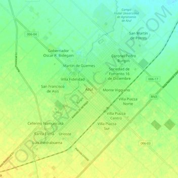
Name: Azul topographic map, elevation, terrain.

Location: Azul, Partido de Azul, Buenos Aires, 7300, Argentina (-36.81749 -59.90344 -36.73749 -59.82344)

Average elevation: 137 m

Minimum elevation: 126 m

Maximum elevation: 147 m

Other topographic maps

Click on a map to view its topography, its elevation and its terrain.

San Isidro

Argentina > Buenos Aires

Average elevation: 17 m

Quilmes

Argentina > Buenos Aires

Average elevation: 11 m

Villa Ventana

Argentina > Buenos Aires > Cuartel VII

Average elevation: 401 m

Pilar

Argentina > Buenos Aires

Average elevation: 19 m

Ingeniero White

Argentina > Buenos Aires

Average elevation: 7 m

San Juan

Argentina > Buenos Aires > Junín

Average elevation: 78 m

Agote

Argentina > Buenos Aires > Agote

Average elevation: 37 m

San Fernando

Argentina > Buenos Aires > San Fernando

Average elevation: 6 m

Gear up for your next adventure:

🚲MTB Frame Bag - Carry tools and maps directly on your bicycle frame
💡Portable Camping Lamp - Rechargeable lamp for campsite lighting
🥫Freeze-Dried Meals - Lightweight, high-calorie nutrition for multi-day treks
Camping Essentials - All-in-one gear for a comfortable camping trip
🥾Trekking Poles - Adjustable trekking poles to reduce knee stress and improve stability

As an Amazon Associate, this site earns from qualifying purchases at no extra cost to you.