Geolocate

Agote topographic map

Click on the map to display elevation.

About this map

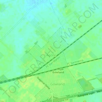
Name: Agote topographic map, elevation, terrain.

Location: Agote, Partido de Mercedes, Buenos Aires, Argentina (-34.64936 -59.36236 -34.63682 -59.34927)

Average elevation: 37 m

Minimum elevation: 30 m

Maximum elevation: 43 m

Gear up for your next adventure:

🦌Outdoor Trail Camera - Monitor wildlife activity near your favorite spots
🧦Outdoor Socks - Durable socks designed for hiking and outdoor sports
💧Hydration Pack - Hands-free hydration system for long hikes
🧥Packable Rain Jacket - Breathable waterproof layer for unpredictable weather
🪑Insulated Seat Pad - Protect your seat from cold rocks and wet logs

As an Amazon Associate, this site earns from qualifying purchases at no extra cost to you.