Geolocate

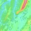
Grayson County topographic map

Click on the map to display elevation.

About this map

Name: Grayson County topographic map, elevation, terrain.

Location: Grayson County, Virginia, United States (36.55913 -81.67746 36.80645 -80.83794)

Average elevation: 822 m

Minimum elevation: 329 m

Maximum elevation: 1,725 m

Other topographic maps

Click on a map to view its topography, its elevation and its terrain.
Round Hill

United States > Virginia > Loudoun County

Average elevation: 177 m

Solsburg

United States > Virginia > Rockingham County > Elkton

Average elevation: 307 m

Newport News

United States > Virginia > Newport News

Average elevation: 4 m

Ingham

United States > Virginia > Page County

Average elevation: 361 m

Good

United States > Virginia > Frederick County

Average elevation: 356 m

Pinnacle

United States > Virginia > Frederick County

Average elevation: 646 m

Greenfields

United States > Virginia > Charlottesville

Average elevation: 136 m

Aldie

United States > Virginia > Loudoun County

Average elevation: 119 m

Belle View

United States > Virginia > Belle View

Average elevation: 21 m

Big Hill

United States > Virginia > Rockbridge County

Average elevation: 486 m

Green Spring

United States > Virginia > Frederick County

Average elevation: 245 m

Old Beach

United States > Virginia > Accomack County

Average elevation: 2 m

Hebron

United States > Virginia > Augusta County > Hebron

Average elevation: 507 m

Gear up for your next adventure:

🧢Hiking Hat - Sun-protective and breathable hats for long treks
🧦Hiking Socks - Moisture-wicking and comfortable socks for long hikes
💧Filtered Water Bottle - Safe drinking water on the go
⛺Camping Essentials - All-in-one gear for a comfortable camping trip
💧Hydration Bladder - Hands-free hydration solution for long treks

As an Amazon Associate, this site earns from qualifying purchases at no extra cost to you.