Geolocate

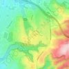
Fullerton topographic map

Click on the map to display elevation.

About this map
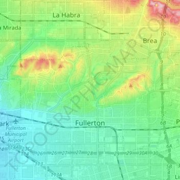
Name: Fullerton topographic map, elevation, terrain.

Location: Fullerton, Orange County, California, United States (33.85416 -117.98542 33.92446 -117.86371)

Average elevation: 79 m

Minimum elevation: 25 m

Maximum elevation: 225 m

Other topographic maps

Click on a map to view its topography, its elevation and its terrain.
Newport Beach

United States > California > Orange County > Newport Beach > Newport Beach

Newport Beach extends in elevation from sea level to the 1,161 ft (354 m) summit of Signal Peak in the San Joaquin Hills, but the official elevation is 25 ft (7.6 m) above sea level at a location of 33°37′0″N 117°53′51″W / 33.61667°N 117.89750°W / 33.61667; -117.89750 (33.616671, −117.897604).

Average elevation: 9 m

Ladera Ranch

United States > California > Orange County

Average elevation: 144 m

Toovunga

United States > California > Orange County > Dana Point

Average elevation: 35 m

Aliso

United States > California > Orange County > Tustin

Average elevation: 30 m

Coto De Caza

United States > California > Orange County

Average elevation: 257 m

Des Moines

United States > California > Orange County > La Habra

Average elevation: 101 m

Silverado

United States > California > Orange County

Average elevation: 485 m

Laurel Canyon

United States > California > Orange County

Average elevation: 198 m

Irvine

United States > California > Orange County > Irvine

Average elevation: 112 m

Silverado

United States > California > Orange County

Average elevation: 485 m

Santa Ana

United States > California > Orange County > Santa Ana

Average elevation: 83 m

Bell Canyon

United States > California > Orange County

Average elevation: 371 m

Anaheim

United States > California > Orange County > Anaheim

Average elevation: 98 m

Cars Land

United States > California > Orange County > Anaheim

Average elevation: 42 m

McPherson

United States > California > Orange County > Orange

Average elevation: 76 m

Bolsa

United States > California > Orange County > Westminster

Average elevation: 17 m

Thurin

United States > California > Orange County > Costa Mesa

Average elevation: 24 m

Thurin

United States > California > Orange County > Costa Mesa

Average elevation: 24 m

Gear up for your next adventure:

🧣Merino Neck Gaiter - Protects against wind, sun, and cold at high altitudes
🚲Heavy Duty Bike Lock - Secure your bike at the trailhead or during stops
⛺Camping Tent - Weather-resistant tents suitable for 2 to 6 people
👟Trail Running Shoes - Agile footwear for fast-paced topographic exploration
🧥Softshell Hiking Jacket - The perfect balance of wind protection and breathability

As an Amazon Associate, this site earns from qualifying purchases at no extra cost to you.