
Looma topographic map
Click on the map to display elevation.
About this map
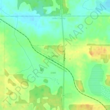
Name: Looma topographic map, elevation, terrain.
Location: Looma, Leduc County, Alberta, Canada (53.35477 -113.25798 53.35955 -113.24513)
Average elevation: 761 m
Minimum elevation: 747 m
Maximum elevation: 776 m
Leduc County trails, hiking, mountain biking, running and outdoor activities
Other topographic maps
Click on a map to view its topography, its elevation and its terrain.
Nisku
Canada > Alberta > Leduc County
Nisku is a hamlet and an industrial/business park in Alberta, Canada, within Leduc County. It has an elevation of 705 metres (2,313 ft).
Average elevation: 714 m