Geolocate

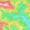
Andagna topographic map

Click on the map to display elevation.

About this map

Name: Andagna topographic map, elevation, terrain.

Location: Andagna, Molini di Triora, Provincia di Imperia, Liguria, Italy (43.97136 7.76405 44.01136 7.80405)

Average elevation: 726 m

Minimum elevation: 364 m

Maximum elevation: 1,578 m

Other topographic maps

Click on a map to view its topography, its elevation and its terrain.

Armo

Italy > Provincia di Imperia

Average elevation: 942 m

Borgomaro

Italy > Provincia di Imperia

Average elevation: 535 m

Pigna

Italy > Provincia di Imperia

Average elevation: 908 m

Lucinasco

Italy > Provincia di Imperia

Average elevation: 404 m

Gear up for your next adventure:

🔭Outdoor Binoculars - Lightweight binoculars for birdwatching and hiking
🧥Waterproof Jacket - Lightweight rain jackets for hiking and outdoor activities
🧥Softshell Jacket - Windproof and breathable jacket for hiking
🧢Outdoor Visor - Breathable visor for sunny hikes
🧢Hiking Hat - Sun-protective and breathable hats for long treks

As an Amazon Associate, this site earns from qualifying purchases at no extra cost to you.