Geolocate

Armo topographic map

Click on the map to display elevation.

About this map
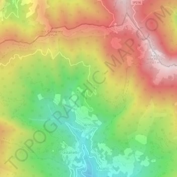
Name: Armo topographic map, elevation, terrain.

Location: Armo, Imperia, Liguria, Italy (44.07948 7.88242 44.11182 7.93463)

Average elevation: 942 m

Minimum elevation: 418 m

Maximum elevation: 1,487 m

Gear up for your next adventure:

🧥Softshell Hiking Jacket - The perfect balance of wind protection and breathability
🧴Bear Spray Holster - Quick-access carry for essential Canadian wilderness safety
💧Filtered Water Bottle - Safe drinking water on the go
🗺️Topographic Maps - Detailed maps to explore trails, mountains, and wilderness areas
🥫Freeze-Dried Meals - Lightweight, high-calorie nutrition for multi-day treks

As an Amazon Associate, this site earns from qualifying purchases at no extra cost to you.