Geolocate

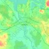
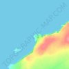
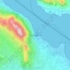
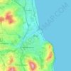
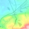
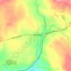
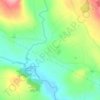
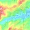
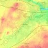
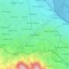
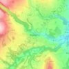
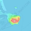
Gortarowey topographic map

Click on the map to display elevation.

About this map

Name: Gortarowey topographic map, elevation, terrain.

Location: Gortarowey, Carney ED, Sligo Municipal Borough District, County Sligo, Connacht, Ireland (54.34909 -8.51849 54.37084 -8.49289)

Average elevation: 114 m

Minimum elevation: 19 m

Maximum elevation: 498 m

Other topographic maps

Click on a map to view its topography, its elevation and its terrain.
Cork

Ireland > County Cork > Cork

Average elevation: 94 m

Athlone

Ireland > County Westmeath > Athlone

Average elevation: 44 m

Galway City

Ireland > Galway City

Average elevation: 26 m

River Shannon

Ireland

Average elevation: 39 m

Cromane

Ireland

Average elevation: 3 m

Maghera Strand

Ireland

Average elevation: 37 m

Knockdrin

Ireland

Average elevation: 96 m

Ballycurry

Ireland

Average elevation: 178 m

Ballyedmond

Ireland

Average elevation: 73 m

Furry Glen

Ireland

Average elevation: 44 m

Trout Lake

Ireland

Average elevation: 81 m

Tory Hill

Ireland

Average elevation: 131 m

Dowth

Ireland

Average elevation: 32 m

Great Skellig

Ireland

Average elevation: 1 m

Spinans Hill

Ireland

Average elevation: 244 m

Gaulstown Castle

Ireland

Average elevation: 181 m

Skeaghvasteen

Ireland

Average elevation: 97 m

Tibberaghny Castle

Ireland

Average elevation: 18 m

Myles Big Stone

Ireland

Average elevation: 89 m

Kilkee Cliffs

Ireland

Average elevation: 19 m

Dunlicky Point

Ireland

Average elevation: 18 m

Doulus Head

Ireland

Average elevation: 16 m

Bolus Head

Ireland

Average elevation: 28 m

Galley Head

Ireland

Average elevation: 3 m

Downeen Point

Ireland

Average elevation: 11 m

Frower Point

Ireland

Average elevation: 20 m

Knockadoon Head

Ireland

Average elevation: 6 m

Mine Head

Ireland

Average elevation: 22 m

Glendoo Mountain

Ireland

Average elevation: 480 m

Crohy Head Sea Arch

Ireland

Average elevation: 28 m

Dawros Bay

Ireland

Average elevation: 6 m

Portacloy Bay

Ireland

Average elevation: 57 m

Mace Head

Ireland

Average elevation: 3 m

Doonbeg Head

Ireland

Average elevation: 32 m

Lambs Head Bay

Ireland

Average elevation: 14 m

Carlingford

Ireland > County Louth > Carlingford

Average elevation: 84 m

Clifden Bay

Ireland

Average elevation: 41 m

Galway Bay

Ireland

Average elevation: 0 m

Dollymount

Ireland

Average elevation: 6 m

Iveagh Gardens

Ireland > County Dublin > Dublin

Average elevation: 17 m

Castleblakeney

Ireland > County Galway

Average elevation: 74 m

Rowlestown

Ireland > County Dublin

Average elevation: 49 m

Ennis

Ireland > County Clare > Ennis

Average elevation: 20 m

Bray

Ireland > County Wicklow > Bray

Average elevation: 58 m

Swords

Ireland > County Dublin > Swords

The medieval town developed in a linear pattern along Main Street, in a roughly north-south direction. Swords has one of the best examples of this settlement pattern in the Dublin region. The round tower, 26m in height, is also an indicator of early Christian settlement. The Irish high king Brian Boru is said…

Average elevation: 28 m

Skerries

Ireland > County Dublin > Skerries

Average elevation: 16 m

Tramore Valley Park

Ireland > County Cork > Cork

Average elevation: 28 m

Farranfore

Ireland > County Kerry

Average elevation: 59 m

Clonbur

Ireland > County Galway

Average elevation: 47 m

Grand Canal Dock

Ireland > Dublin

Average elevation: 8 m

Tallaght

Ireland > County Dublin

Average elevation: 121 m

Ardgroom

Ireland > County Cork

Average elevation: 56 m

Brittas

Ireland > County Dublin

Average elevation: 250 m

Loughmore

Ireland > County Tipperary

Average elevation: 111 m

Doolin Cave

Ireland > County Clare

Average elevation: 87 m

Annestown

Ireland > County Waterford > Annestown

Average elevation: 26 m

Aughagower

Ireland > County Mayo > Aughagower

Average elevation: 70 m

Milltown River

Ireland > County Kerry

Average elevation: 27 m

Ennistimon

Ireland > County Clare > Ennistimon

Average elevation: 61 m

Barraduff

Ireland > County Kerry > Barraduff

Average elevation: 124 m

Kells Round Tower

Ireland > County Meath

Average elevation: 69 m

Knock

Ireland > County Mayo

Average elevation: 94 m

Mahon Falls

Ireland > County Waterford

Average elevation: 575 m

Ballincollig

Ireland > County Cork > Cork

Average elevation: 62 m

Cappalusk

Ireland > County Galway

Average elevation: 98 m

Killorglin

Ireland > County Kerry

Average elevation: 24 m

Clondrohid

Ireland > County Cork

Average elevation: 151 m

Ardrahan

Ireland > County Galway

Average elevation: 32 m

Clarecastle

Ireland > County Clare

Average elevation: 7 m

Donabate Beach

Ireland > County Dublin

Average elevation: 2 m

Ballysloe

Ireland > County Tipperary

Average elevation: 175 m

Ballinacourty

Ireland > County Waterford

Average elevation: 3 m

Easky

Ireland > County Sligo

In Samuel Lewis's 1837 publication of A Topographical Dictionary of Ireland, Easky was described as having 6,124 inhabitants, of which 289 were in the village. Lewis noted that the village (made up of one long street) had petty sessions every fortnight and that Wednesday was market day. As well as other more…

Average elevation: 17 m

Trim Castle Keep

Ireland > County Meath > Trim

Average elevation: 62 m

Carlow

Ireland > Carlow

Average elevation: 63 m

Letterkenny

Ireland > County Donegal > Letterkenny

Average elevation: 93 m

Kildare

Ireland > Kildare

Average elevation: 102 m

Naas

Ireland > Naas

Average elevation: 102 m

Dundalk

Ireland > County Louth > Dundalk

Average elevation: 16 m

Drogheda

Ireland > County Louth > Drogheda

Average elevation: 38 m

Clonmel

Ireland > County Tipperary > Clonmel

Average elevation: 106 m

Dungarvan

Ireland > County Waterford

Average elevation: 30 m

Mullingar

Ireland > County Westmeath

Average elevation: 101 m

Killarney

Ireland > County Kerry > Killarney

Average elevation: 66 m

Midleton

Ireland > Midleton

Average elevation: 42 m

Mallow

Ireland > County Cork > Mallow

Average elevation: 106 m

Clonakilty

Ireland > Clonakilty

Average elevation: 49 m

Balbriggan

Ireland > County Dublin > Balbriggan

Average elevation: 25 m

Greystones

Ireland > County Wicklow

Greystones is located south of the site of an ancient castle of the Barony of Rathdown. There was a hamlet which, like Rathdown Castle, was known as Rathdown, and which appeared on a 1712 map. This site occupied an area now known as the Grove, north of Greystones harbour, but only the ruins of a chapel, St.…

Average elevation: 49 m

Tramore

Ireland > Tramore

Average elevation: 30 m

Limerick

Ireland > Limerick

Limerick's climate is classified as temperate oceanic (Köppen Cfb). Met Éireann maintains a climatological weather station at Shannon Airport, 20 kilometres west of the city in County Clare. Shannon Airport records an average of 977 millimetres of precipitation annually, most of which is rain. Limerick has a…

Average elevation: 54 m
Bailieborough

Ireland > County Cavan > Bailieborough

Average elevation: 169 m

Celbridge

Ireland > County Kildare > Celbridge

Average elevation: 64 m

Blackrock

Ireland > County Dublin

Average elevation: 30 m

Killinick

Ireland > County Wexford

Average elevation: 12 m

Blessington

Ireland > County Wicklow > Blessington

Average elevation: 223 m

Dundrum

Ireland > County Dublin

Average elevation: 79 m

Enniskerry

Ireland > County Wicklow > Enniskerry

Average elevation: 118 m

Howth

Ireland > County Dublin

Average elevation: 8 m

Gear up for your next adventure:

💧Hydration Pack - Hands-free hydration system for long hikes
🕯️Camping Lantern - Illuminates your entire campsite with high-efficiency LEDs
🦶Anti-Blister Balm - Prevents friction and hotspots during long ascents
💡LED Camping Lantern - Illuminate your campsite with long-lasting lanterns
💧Collapsible Water Bottle - Space-saving water bottle for outdoor activities

As an Amazon Associate, this site earns from qualifying purchases at no extra cost to you.