Swords topographic map
Click on the map to display elevation.
Swords
The medieval town developed in a linear pattern along Main Street, in a roughly north-south direction. Swords has one of the best examples of this settlement pattern in the Dublin region. The round tower, 26m in height, is also an indicator of early Christian settlement. The Irish high king Brian Boru is said to have had his funeral at the church on Spittal Hill after he was killed at the Battle of Clontarf; this was of course before the hospital and even the Church of Ireland when there would have been a small chapel there along with the round tower. At the northern end of the street stands Swords Castle, 200m northeast of the ecclesiastical site, which was built in the early 13th century. A short distance north of the Castle is an elevation known as Spittal Hill, where a hospital once stood.
About this map
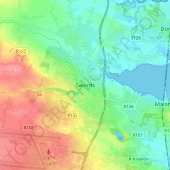
Name: Swords topographic map, elevation, terrain.
Location: Swords, Fingal, County Dublin, Leinster, K67 X8Y2, Ireland (53.41983 -6.25846 53.49983 -6.17846)
Average elevation: 28 m
Minimum elevation: -19 m
Maximum elevation: 80 m
Other topographic maps
Click on a map to view its topography, its elevation and its terrain.