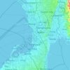
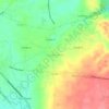
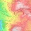
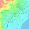
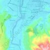
Quezon City topographic map
Click on the map to display elevation.
Quezon City
In order to make Quezon's dream a reality and to mobilize funds for the land purchase, the People's Homesite Corporation (PHC) was created on October 14, 1938, as a subsidiary of NDC, with an initial capital of ₱2 million. Roces was the chairman of the Board of PHC, and they immediately acquired the vast Diliman Estate of the Tuason family at a cost of 5 centavos per square meter. PHC conducted topographical and subdivision surveys, and then subdivided the lots and sold them to the target buyers at an affordable price. Its target users and beneficiaries were Manila's working class, who were suffering from a shortage of affordable and decent housing in the capital. The service of the Metropolitan Waterworks system was extended to site. The Bureau of Public Works, then under Secretary Vicente Fragante, constructed the streets and highways within the property. Quezon also tapped Architect Juan M. Arellano to draft a design of the city. Eight vast estates were acquired in order to create Quezon City: Diliman Estate, 1,573.22 hectares (15.7322 km2), Santa Mesa Estate, 861.79 hectares (8.6179 km2), Mandaluyong Estate, 781.36 hectares (7.8136 km2), Magdalena Estate, 764.48 hectares (7.6448 km2), Piedad Estate, 743.84 hectares (7.4384 km2), Maysilo Estate, 266.73 hectares (2.6673 km2) and the San Francisco Del Monte Estate, 257.54 hectares (2.5754 km2). Quezon's goal was to create a place for the working class, coinciding with the planned transfer of the University of the Philippines campus in Manila to a more suitable location, which became another precedent for the creation of Quezon City.
About this map
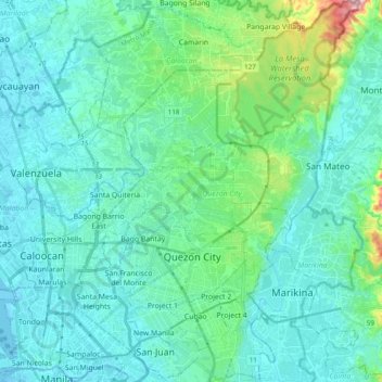
Name: Quezon City topographic map, elevation, terrain.
Average elevation: 39 m
Minimum elevation: -2 m
Maximum elevation: 252 m
Other topographic maps
Click on a map to view its topography, its elevation and its terrain.

Quezon City
Founded as a pueblo by Saint Pedro Bautista in 1590, San Francisco del Monte may be considered Quezon City's oldest district. The original land area of the old town of San Francisco del Monte was approximately2.5 square kilometres (1.0 sq mi) and covered parts of what is currently known as Project 7 and 8 and…
Average elevation: 57 m
Baguio
In 1903, Filipinos, Japanese and Chinese workers were hired to build Kennon Road, the first road directly connecting Baguio with the lowlands of La Union and Pangasinan. Before this, the only road to Benguet was Naguilian Road, and it was largely a horse trail at higher elevations. Camp John Hay was…
Average elevation: 881 m
Valenzuela
The highest elevation point is 38 meters (125 ft) above sea level. Having a surface gradient of 0.55% and a gentle slope, hilly landscape is located in the industrial section of the city in Canumay. The average elevation point is 2 meters (6.6 ft) above sea level.
Average elevation: 24 m



Mount Pulag
At lower elevations, Mount Pulag has a mossy forest full of ferns, lichens, and moss.
Average elevation: 2,572 m
San Juan
"San Juan" is a contraction of the city's traditional name of "San Juan del Monte" (lit. 'Saint John of the Mountain'). As with numerous other places in the Philippines, the name combines a patron saint and a toponym; in this case Saint John the Baptist with the locale's hilly terrain and relatively higher…
Average elevation: 35 m
Bacolod
Bacólod (English: Bacolod), is derived from bakólod (Old Spelling: bacólod), the Old Hiligaynon (Old Ilonggo) (Old Spelling: Ylongo and Ilongo) word for a "hill, turtle, mound, rise, hillock, down, any small eminence or elevation", since the resettlement was founded on a stony, hilly area, now the barangay…
Average elevation: 49 m
Mandaluyong
Another claims that the Spaniards named the place based on the report of a navigator named Acapulco, who saw the rolling hills frequently being lashed at by daluyong (“big waves from the sea”). This seems to confirm traditional pre-Hispanic stories that giant waves from the sea would meet the adjoining…
Average elevation: 33 m





Legazpi
Legazpi's topography is generally plain on the northeastern areas, with slopes ranging from five to fifteen degrees. The southern areas have mostly rolling to hilly terrain. In the city's coastal areas, the terrain varies from plain (north) to hilly (south). Legazpi is criss-crossed by several rivers including…
Average elevation: 150 m

Mandaue
It is one of the two (the other one being the municipality of Consolacion) local government units located within the mainland Metro Cebu where the elevation of land is less than 100 m (330 ft).
Average elevation: 109 m

Tagum
One of the significant accomplishments of the officialdom of Tagum during the 1990s was its elevation from a second to the first-class municipality. This opened a gateway to increase its financial resources through the Internal Revenue Allocation (IRA) from the national government and local revenues. This was…
Average elevation: 103 m