Geolocate

Mount Pulag topographic map

Click on the map to display elevation.

Mount Pulag

At lower elevations, Mount Pulag has a mossy forest full of ferns, lichens, and moss.

Wikipedia (CC-BY-SA 3.0)

About this map

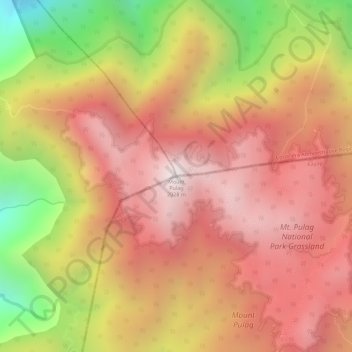
Name: Mount Pulag topographic map, elevation, terrain.

Location: Mount Pulag, Nueva Vizcaya, Cagayan Valley, Philippines (16.59768 120.89874 16.59778 120.89884)

Average elevation: 2,572 m

Minimum elevation: 1,969 m

Maximum elevation: 2,913 m

Gear up for your next adventure:

🔦LED Headtorch - Bright and durable light for night activities
💧Hydration Pack - Hands-free hydration system for long hikes
🧦Merino Wool Socks - Moisture-wicking comfort for long-distance hiking
🧴Waterproofing Spray - Restore the DWR coating on jackets and tents
🔦UV Flashlight - Detect minerals or specific insects in the dark

As an Amazon Associate, this site earns from qualifying purchases at no extra cost to you.