Geolocate

Daisy Lake topographic map

Click on the map to display elevation.

About this map
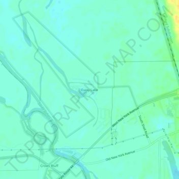
Name: Daisy Lake topographic map, elevation, terrain.

Location: Daisy Lake, Volusia County, Florida, United States (29.00471 -81.39895 29.04471 -81.35895)

Average elevation: 6 m

Minimum elevation: 0 m

Maximum elevation: 23 m

Other topographic maps

Click on a map to view its topography, its elevation and its terrain.

Pierson

United States > Florida > Volusia County

Average elevation: 14 m

Shelby Lake

United States > Florida > Volusia County > Deltona

Average elevation: 24 m

DeLeon Spring

United States > Florida > Volusia County

Average elevation: 12 m

Glencoe

United States > Florida > Volusia County > Glencoe

Average elevation: 8 m

Lorraine Lake

United States > Florida > Volusia County > Deltona

Average elevation: 20 m

Gear up for your next adventure:

🧥Insulated Jacket - Keep warm in cold outdoor conditions
🧥Softshell Hiking Jacket - The perfect balance of wind protection and breathability
🧦Hiking Socks - Moisture-wicking and comfortable socks for long hikes
⛺Camping Groundsheet - Protect your tent from moisture and dirt
🧤Rechargeable Heated Gloves - Extreme warmth for Canadian winter expeditions

As an Amazon Associate, this site earns from qualifying purchases at no extra cost to you.