Geolocate

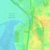
Barberville topographic map

Click on the map to display elevation.

About this map

Name: Barberville topographic map, elevation, terrain.

Location: Barberville, Volusia County, Florida, 32105, United States (29.16720 -81.44090 29.20720 -81.40090)

Average elevation: 12 m

Minimum elevation: 5 m

Maximum elevation: 25 m

Other topographic maps

Click on a map to view its topography, its elevation and its terrain.

Pierson

United States > Florida > Volusia County

Average elevation: 14 m

Shelby Lake

United States > Florida > Volusia County > Deltona

Average elevation: 24 m

DeLeon Spring

United States > Florida > Volusia County

Average elevation: 12 m

Glencoe

United States > Florida > Volusia County > Glencoe

Average elevation: 8 m

Lorraine Lake

United States > Florida > Volusia County > Deltona

Average elevation: 20 m

Gear up for your next adventure:

⛺Camping Tent - Weather-resistant tents suitable for 2 to 6 people
🥾All-Terrain Hiking Boots - Versatile boots for varied hiking conditions
🧊Insulated Water Bottle - Keeps drinks cold in summer and prevents freezing in winter
🧴Bear Spray Holster - Quick-access carry for essential Canadian wilderness safety
🦯Trekking Poles - Reduced impact on joints for steep topographic climbs

As an Amazon Associate, this site earns from qualifying purchases at no extra cost to you.