Geolocate

Lu'an topographic map

Click on the map to display elevation.

About this map
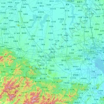
Name: Lu'an topographic map, elevation, terrain.

Location: Lu'an, Anhui, China (31.01064 115.36585 32.60853 117.24951)

Average elevation: 141 m

Minimum elevation: 4 m

Maximum elevation: 1,713 m

Other topographic maps

Click on a map to view its topography, its elevation and its terrain.

Yingjiang

China > Anhui

Average elevation: 34 m

Ningguo

China > Anhui > Ningguo > Xijin Subdistrict

Average elevation: 158 m

Guangde

China > Anhui > Guangde > 桐汭街道

Average elevation: 96 m

Sucun

China > Anhui > Huangshan City

Average elevation: 266 m

Gear up for your next adventure:

🧥Ultralight Puffy Jacket - Maximum warmth that packs down to the size of an orange
🧭GPS Handheld Device - Reliable GPS navigation for outdoor adventures
💡Portable Camping Lamp - Rechargeable lamp for campsite lighting
🗺️Topographic Maps - Detailed maps to explore trails, mountains, and wilderness areas
💡LED Headlamp - Hands-free illumination for night hiking and camping

As an Amazon Associate, this site earns from qualifying purchases at no extra cost to you.