Geolocate

Sucun topographic map

Click on the map to display elevation.

About this map

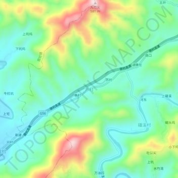
Name: Sucun topographic map, elevation, terrain.

Location: Sucun, Huangshan City, Anhui, China (29.95953 118.68142 29.99953 118.72142)

Average elevation: 266 m

Minimum elevation: 140 m

Maximum elevation: 546 m

Other topographic maps

Click on a map to view its topography, its elevation and its terrain.

Yuzhong Subdistrict

China > Anhui > Huangshan City

Average elevation: 138 m

Gear up for your next adventure:

🧰Multitool Knife - Compact and versatile tool for outdoor use
🧦Outdoor Socks - Durable socks designed for hiking and outdoor sports
🥾Mountain Trail Shoes - High-traction shoes for mountain trails
🎒Hiking Backpack - Lightweight and ergonomic backpacks for day hikes or multi-day treks
🥾Hiking Shoes - Durable and comfortable shoes for trail hiking

As an Amazon Associate, this site earns from qualifying purchases at no extra cost to you.