Geolocate

Guangde topographic map

Click on the map to display elevation.

About this map

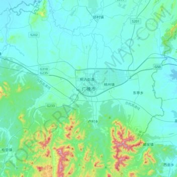
Name: Guangde topographic map, elevation, terrain.

Location: Guangde, 桐汭街道, Guangde, Anhui, China (30.71913 119.25541 31.03913 119.57541)

Average elevation: 96 m

Minimum elevation: 11 m

Maximum elevation: 657 m

Gear up for your next adventure:

🛶Waterproof Dry Bags - Keep electronics and clothes dry during river crossings
Lightweight Backpacking Tent - Compact tent for efficient hiking trips
💧Reusable Water Bottle - Durable water bottles for hydration on trails
🧭Orienteering Kit - Tools for map reading and navigation in the wild
🔋Solar Power Bank - Keep your GPS and devices charged during long outdoor trips

As an Amazon Associate, this site earns from qualifying purchases at no extra cost to you.