Geolocate

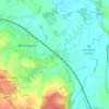
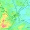
Alrewas topographic map

Click on the map to display elevation.

About this map
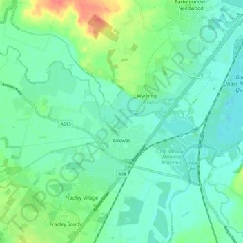
Name: Alrewas topographic map, elevation, terrain.

Location: Alrewas, Fradley, Lichfield, Staffordshire, England, United Kingdom (52.72261 -1.81107 52.75097 -1.71694)

Average elevation: 59 m

Minimum elevation: 44 m

Maximum elevation: 100 m

Other topographic maps

Click on a map to view its topography, its elevation and its terrain.

Watford Gap

United Kingdom > England > Staffordshire > Lichfield

Average elevation: 131 m

Fradley

United Kingdom > England > Staffordshire > Lichfield

Average elevation: 59 m

Chasetown

United Kingdom > England > Staffordshire > Lichfield

Average elevation: 155 m

Hopwas

United Kingdom > England > Staffordshire > Lichfield

Average elevation: 82 m

Streethay

United Kingdom > England > Staffordshire > Lichfield

Average elevation: 73 m

Handsacre

United Kingdom > England > Staffordshire > Lichfield

Average elevation: 74 m

Croxall

United Kingdom > England > Staffordshire > Lichfield

Average elevation: 57 m

Little Aston

United Kingdom > England > Staffordshire > Lichfield

Average elevation: 142 m

Edingale

United Kingdom > England > Staffordshire > Lichfield

Average elevation: 63 m

Beacon Park

United Kingdom > England > Staffordshire > Lichfield

Average elevation: 93 m

Lynn

United Kingdom > England > Staffordshire > Lichfield > Stonnall

Average elevation: 128 m

Gentleshaw

United Kingdom > England > Staffordshire > Lichfield > Longdon

Average elevation: 174 m

Armitage

United Kingdom > England > Staffordshire > Lichfield

Average elevation: 80 m

Aldershawe

United Kingdom > England > Staffordshire > Lichfield

Average elevation: 102 m

Pipehill

United Kingdom > England > Staffordshire > Lichfield > Woodhouses

Average elevation: 111 m

Watford Gap

United Kingdom > England > Staffordshire > Lichfield

Average elevation: 131 m

Watford Gap

United Kingdom > England > Staffordshire > Lichfield

Average elevation: 131 m

Handsacre

United Kingdom > England > Staffordshire > Lichfield

Average elevation: 77 m

Gear up for your next adventure:

🏃Hydration Running Vest - Carry water and maps close to your body for speed
🎒Hiking Backpack - Lightweight and ergonomic backpacks for day hikes or multi-day treks
🛶Canoe Life Vest - Safety vest for water sports
🛌Insulated Sleeping Pad - Critical thermal barrier between you and the cold ground
🔋Solar Power Bank - Keep your GPS and devices charged during long outdoor trips

As an Amazon Associate, this site earns from qualifying purchases at no extra cost to you.