Geolocate

Cliffsend topographic map

Click on the map to display elevation.

About this map

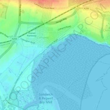
Name: Cliffsend topographic map, elevation, terrain.

Location: Cliffsend, Thanet, Kent, England, United Kingdom (51.31125 1.35169 51.33819 1.38305)

Average elevation: 11 m

Minimum elevation: 0 m

Maximum elevation: 50 m

Other topographic maps

Click on a map to view its topography, its elevation and its terrain.

Broadstairs

United Kingdom > England > Kent > Thanet

Average elevation: 14 m

Minnis Bay

United Kingdom > England > Kent > Thanet

Average elevation: 6 m

Dane Park

United Kingdom > England > Kent > Thanet > Margate

Average elevation: 18 m

Haine

United Kingdom > England > Kent > Thanet > Ramsgate > Westwood

Average elevation: 42 m

Weatherlees Hill

United Kingdom > England > Kent > Thanet > Ebbsfleet

Average elevation: 4 m

Hoo

United Kingdom > England > Kent > Thanet > Minster

Average elevation: 16 m

Pegwell Bay

United Kingdom > England > Kent > Thanet > Cliffsend

Average elevation: 9 m

Flete

United Kingdom > England > Kent > Thanet > Manston

Average elevation: 39 m

Ebbsfleet

United Kingdom > England > Kent > Thanet

Average elevation: 4 m

Birchington

United Kingdom > England > Kent > Thanet

Average elevation: 15 m

Way

United Kingdom > England > Kent > Thanet > Minster > Way

Average elevation: 23 m

Broadstairs

United Kingdom > England > Kent > Thanet

Average elevation: 14 m

Ebbsfleet

United Kingdom > England > Kent > Thanet

Average elevation: 4 m

Gear up for your next adventure:

🧤Insulated Winter Gloves - Heavy-duty protection for sub-zero Canadian adventures
Bushcraft Tarp - Versatile emergency shelter or gear protection
🧭GPS Handheld Device - Reliable GPS navigation for outdoor adventures
🥾Hiking Shorts - Breathable shorts suitable for summer hikes
🔭Compact Monocular - One-handed bird watching and trail spotting

As an Amazon Associate, this site earns from qualifying purchases at no extra cost to you.