
Thank you for supporting this site ❤️
Make a donation
Make a donation
Gear up for your next adventure:
As an Amazon Associate, this site earns from qualifying purchases at no extra cost to you.
Gemeinde Zams topographic map
Click on the map to display elevation.
Thank you for supporting this site ❤️
Make a donation
Make a donation
Gear up for your next adventure:
As an Amazon Associate, this site earns from qualifying purchases at no extra cost to you.
About this map
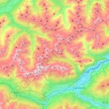
Name: Gemeinde Zams topographic map, elevation, terrain.
Location: Gemeinde Zams, Bezirk Landeck, Tyrol, 6511, Austria (47.14021 10.42341 47.24914 10.67674)
Average elevation: 1,789 m
Minimum elevation: 749 m
Maximum elevation: 3,009 m
Thank you for supporting this site ❤️
Make a donation
Make a donation
Gear up for your next adventure:
As an Amazon Associate, this site earns from qualifying purchases at no extra cost to you.