Geolocate

Tscheyegg topographic map

Click on the map to display elevation.

About this map

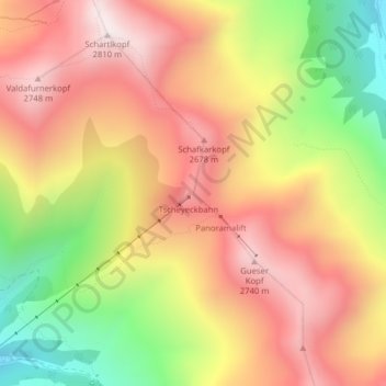
Name: Tscheyegg topographic map, elevation, terrain.

Location: Tscheyegg, Gemeinde Nauders, Bezirk Landeck, Tyrol, Austria (46.88879 10.57071 46.88889 10.57081)

Average elevation: 2,409 m

Minimum elevation: 1,915 m

Maximum elevation: 2,788 m

Gear up for your next adventure:

🚲Bike Repair Kit - Essential tools for on-trail mechanical issues
🧥Fleece Jacket - Warm and lightweight jacket for layering
💧Reusable Water Bottle - Durable water bottles for hydration on trails
🧴Bear Spray Holster - Quick-access carry for essential Canadian wilderness safety
🧢Outdoor Visor - Breathable visor for sunny hikes

As an Amazon Associate, this site earns from qualifying purchases at no extra cost to you.