Geolocate

Komperdell topographic map

Click on the map to display elevation.

About this map

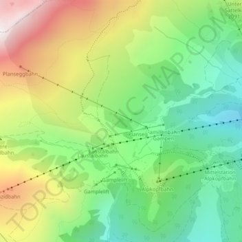
Name: Komperdell topographic map, elevation, terrain.

Location: Komperdell, Serfaus, Bezirk Landeck, Tyrol, 6534, Austria (47.03248 10.55444 47.05248 10.57444)

Average elevation: 2,012 m

Minimum elevation: 1,586 m

Maximum elevation: 2,655 m

Other topographic maps

Click on a map to view its topography, its elevation and its terrain.

6534

Austria > Tyrol > Bezirk Landeck > Serfaus

Average elevation: 1,979 m

Gear up for your next adventure:

🔥Emergency Fire Starter - Reliable ignition source for all weather conditions
🧥Fleece Jacket - Warm and lightweight jacket for layering
🥾Trail Running Boots - Durable shoes designed for trail running
🥾All-Terrain Hiking Boots - Versatile boots for varied hiking conditions
🧴First Aid Kit - Essential first aid supplies for outdoor emergencies

As an Amazon Associate, this site earns from qualifying purchases at no extra cost to you.