
Giants Tomb Island topographic map
Interactive map
Click on the map to display elevation.
About this map
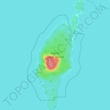
Name: Giants Tomb Island topographic map, elevation, terrain.
Average elevation: 178 m
Minimum elevation: 172 m
Maximum elevation: 238 m
Simcoe County trails, hiking, mountain biking, running and outdoor activities
Other topographic maps
Click on a map to view its topography, its elevation and its terrain.
Wasaga Beach
Canada > Ontario > Simcoe County
The Town of Wasaga Beach covers an area of 61.13 square kilometres (23.60 sq mi) comprised predominantly of sand and loamy sand that exhibit excessive to good drainage and irregular to moderately sloping topography. The poor soil quality makes it difficult to sustain lush lawns in the town. The Canada Land…
Average elevation: 190 m
Wasaga Beach
Canada > Ontario > Simcoe County
The Town of Wasaga Beach covers an area of 61.13 square kilometres (23.60 sq mi) composed predominantly of sand and loamy sand that exhibit excessive to good drainage and irregular to moderately sloping topography. The poor soil quality makes it difficult to sustain lush lawns in the town. The Canada Land…
Average elevation: 190 m
Wasaga Beach Provincial Park
Canada > Ontario > Simcoe County > Wasaga Beach
The Town of Wasaga Beach covers an area of 61.13 square kilometres (23.60 sq mi) comprised predominantly of sand and loamy sand that exhibit excessive to good drainage and irregular to moderately sloping topography. The poor soil quality makes it difficult to sustain lush lawns in the town. The Canada Land…
Average elevation: 185 m
Springhurst Beach
Canada > Ontario > Simcoe County > Wasaga Beach > Springhurst Beach
Average elevation: 184 m