
Soppeng topographic map
Click on the map to display elevation.
About this map
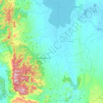
Name: Soppeng topographic map, elevation, terrain.
Location: Soppeng, South Sulawesi, Sulawesi, Indonesia (-4.54393 119.70624 -4.09415 120.09613)
Average elevation: 233 m
Minimum elevation: -2 m
Maximum elevation: 1,425 m
Other topographic maps
Click on a map to view its topography, its elevation and its terrain.