Geolocate

Stair topographic map

Click on the map to display elevation.

About this map

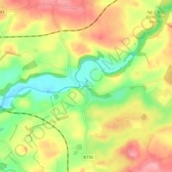
Name: Stair topographic map, elevation, terrain.

Location: Stair, East Ayrshire, Scotland, KA5 5HW, United Kingdom (55.46031 -4.49091 55.50031 -4.45091)

Average elevation: 81 m

Minimum elevation: 33 m

Maximum elevation: 128 m

Other topographic maps

Click on a map to view its topography, its elevation and its terrain.

River Doon

United Kingdom > Scotland > East Ayrshire > Dalrymple

Average elevation: 168 m

River Ayr

United Kingdom > Scotland > East Ayrshire

Average elevation: 210 m

Glenbuck Loch

United Kingdom > Scotland > East Ayrshire

Average elevation: 327 m

Braid Wood

United Kingdom > Scotland > East Ayrshire

Average elevation: 114 m

Loch Doon

United Kingdom > Scotland > East Ayrshire

Average elevation: 291 m

Gear up for your next adventure:

📷Outdoor Action Camera - Capture high-elevation views and rugged adventures
🧤Thermal Hiking Gloves - Grip-enhanced gloves for cold-weather altitude trekking
🎒Hiking Daypack - Lightweight and durable backpacks for day trips and excursions
💧Collapsible Water Bottle - Space-saving water bottle for outdoor activities
🧴Outdoor Sunscreen - High SPF protection for high-altitude UV exposure

As an Amazon Associate, this site earns from qualifying purchases at no extra cost to you.