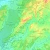
Elbergen topographic map
Click on the map to display elevation.
About this map

Name: Elbergen topographic map, elevation, terrain.
Location: Elbergen, Emsbüren, Landkreis Emsland, Lower Saxony, Germany (52.43421 7.28882 52.47421 7.32882)
Average elevation: 28 m
Minimum elevation: 17 m
Maximum elevation: 44 m
Other topographic maps
Click on a map to view its topography, its elevation and its terrain.

Haren (Ems)
Germany > Lower Saxony > Landkreis Emsland
Haren is located along the River Ems in the central part of Emsland, positioned between Meppen to the south and Papenburg to the north. Neighbouring the Netherlands, Haren has an area of 208.79 square kilometers (80.61 sq mi) and reaches a maximum elevation of 15 meters above sea level.
Average elevation: 16 m