

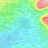
El Marqués topographic map
Click on the map to display elevation.
About this map

Name: El Marqués topographic map, elevation, terrain.
Location: El Marqués, Querétaro, Mexico (20.50093 -100.40724 20.97100 -100.15491)
Average elevation: 2,091 m
Minimum elevation: 1,734 m
Maximum elevation: 3,340 m
Other topographic maps
Click on a map to view its topography, its elevation and its terrain.


Santiago de Querétaro
Mexico > Querétaro > Municipio de Querétaro
The municipality has rolling hills, mountain ranges and flatlands. Most of the rolling hills cross the territory from south to north, paralleling the Querétaro-San Luis Potosí highway. Most plains are located in the north, and are of sedimentary soil with some protrusions of volcanic rock. Altitude varies…
Average elevation: 1,966 m


Mirador de Cuatro Palos
Mexico > Querétaro > Pinal de Amoles > Cuesta Colorada > Maguey Verde
Average elevation: 2,304 m


Parque Queretaro 2000
Mexico > Querétaro > Municipio de Querétaro > Querétaro
Average elevation: 1,853 m


Cuidad Vive Oriente
Mexico > Querétaro > San Juan del Río > San Juan del Río
Average elevation: 1,990 m


