Geolocate

La Cañada topographic map

Click on the map to display elevation.

About this map

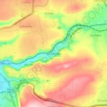
Name: La Cañada topographic map, elevation, terrain.

Location: La Cañada, Querétaro, El Marqués, Querétaro, 76060, Mexico (20.56956 -100.36751 20.64956 -100.28751)

Average elevation: 1,959 m

Minimum elevation: 1,835 m

Maximum elevation: 2,069 m

Gear up for your next adventure:

🧢Sun Hat - Wide-brim hat for sun protection
🔭Compact Binoculars - Lightweight optics for scouting trails and wildlife
🧥Softshell Hiking Jacket - The perfect balance of wind protection and breathability
🥾Waterproof Trail Shoes - Shoes designed to handle wet terrain
🦶Hiking Shoe Insoles - Added support for high arches and long days on feet

As an Amazon Associate, this site earns from qualifying purchases at no extra cost to you.