Geolocate

Galeras topographic map

Click on the map to display elevation.

About this map
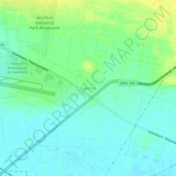
Name: Galeras topographic map, elevation, terrain.

Location: Galeras, Colón, Querétaro, 76295, Mexico (20.59511 -100.17786 20.63511 -100.13786)

Average elevation: 1,915 m

Minimum elevation: 1,907 m

Maximum elevation: 1,929 m

Gear up for your next adventure:

🚑Survival Whistle - Signal for help across long distances in mountains
👟Sport Hiking Sandals - Breathable footwear for water crossings and camp rest
☕Camping Coffee Maker - Brew fresh coffee anywhere on the topographic map
⛺Tent Footprint - Protect tent floor and increase durability
🧢Hiking Sun Hat - Wide-brimmed protection for exposed mountain ridges

As an Amazon Associate, this site earns from qualifying purchases at no extra cost to you.