
Maros topographic map
Click on the map to display elevation.
About this map
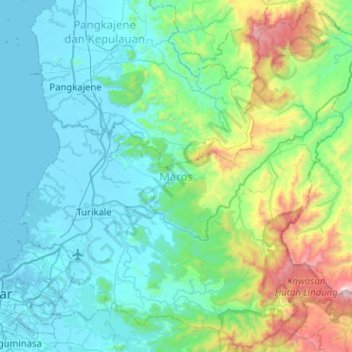
Name: Maros topographic map, elevation, terrain.
Location: Maros, South Sulawesi, Sulawesi, Indonesia (-5.21162 119.46663 -4.71909 119.97593)
Average elevation: 331 m
Minimum elevation: -3 m
Maximum elevation: 1,938 m
Other topographic maps
Click on a map to view its topography, its elevation and its terrain.