Geolocate

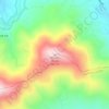
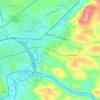
Dragon's Tooth topographic map

Click on the map to display elevation.

About this map

Name: Dragon's Tooth topographic map, elevation, terrain.

Location: Dragon's Tooth, Roanoke County, Virginia, 24070, United States (37.36036 -80.17347 37.36083 -80.17318)

Average elevation: 687 m

Minimum elevation: 543 m

Maximum elevation: 903 m

Other topographic maps

Click on a map to view its topography, its elevation and its terrain.
Bent Mountain

United States > Virginia > Roanoke County

Average elevation: 826 m

Jones

United States > Virginia > Roanoke County

Average elevation: 389 m

Masons Knob

United States > Virginia > Roanoke County

Average elevation: 650 m

Riverside

United States > Virginia > Roanoke County

Average elevation: 411 m

Glenvar

United States > Virginia > Roanoke County

Average elevation: 358 m

Wabun

United States > Virginia > Roanoke County

Average elevation: 398 m

Hollins

United States > Virginia > Roanoke County > Hollins

Average elevation: 355 m

Branderwood

United States > Virginia > Roanoke County

Average elevation: 405 m

Vinton

United States > Virginia > Roanoke County

Vinton has varied topography, considering its 3.2 square mile size. The above-mentioned lake is at an elevation of 890 feet (270 m) above sea level. The Vinton side of the lake consists of a steep, wooded cliff 150 feet (46 m) in vertical height. Vinton's highest point is on Olney Road, at an elevation of…

Average elevation: 304 m

Hollins

United States > Virginia > Roanoke County > Hollins

Average elevation: 359 m

Gear up for your next adventure:

🧰Multitool Knife - Compact and versatile tool for outdoor use
🛶Kayak Accessories - Essential gear for safe and fun kayaking adventures
Lightweight Backpacking Tent - Compact tent for efficient hiking trips
🔨Vehicle Emergency Tool - Safety tool for remote road trips to trailheads
🧥Waterproof Hiking Jacket - Protect yourself from rain and wind while hiking

As an Amazon Associate, this site earns from qualifying purchases at no extra cost to you.