Geolocate

Cave Spring topographic map

Click on the map to display elevation.

About this map

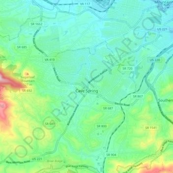
Name: Cave Spring topographic map, elevation, terrain.

Location: Cave Spring, Roanoke County, Virginia, 24018, United States (37.20075 -80.05141 37.26307 -79.95602)

Average elevation: 371 m

Minimum elevation: 285 m

Maximum elevation: 650 m

Gear up for your next adventure:

🧤Thermal Hiking Gloves - Grip-enhanced gloves for cold-weather altitude trekking
🧭GPS Outdoor Watch - Smart watch for navigation and fitness tracking in nature
💡Portable Camping Lamp - Rechargeable lamp for campsite lighting
🧤Insulated Winter Gloves - Heavy-duty protection for sub-zero Canadian adventures
🧥Softshell Jacket - Windproof and breathable jacket for hiking

As an Amazon Associate, this site earns from qualifying purchases at no extra cost to you.