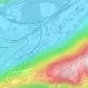
Martigny topographic map
Click on the map to display elevation.
Martigny
Martigny (French pronunciation: [maʁtiɲi]; German: Martinach, pronounced [ˈmaʁtiːnaːx]; Latin: Octodurum) is the capital city of the district of Martigny, canton of Valais, Switzerland. It lies at an elevation of 471 meters (1,545 ft), and its population is approximately 20,000 inhabitants (Martignerains or "Octoduriens"). It is a junction of roads joining Italy, France and Switzerland. One road links it over the Great St. Bernard Pass to Aosta (Italy), and the other over the col de la Forclaz to Chamonix (France). In winter, Martigny is known for its numerous nearby Alp ski resorts such as Verbier.
About this map
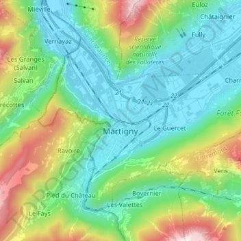
Name: Martigny topographic map, elevation, terrain.
Location: Martigny, Wallis, Switzerland (46.07339 7.02846 46.14067 7.15726)
Average elevation: 917 m
Minimum elevation: 448 m
Maximum elevation: 2,232 m
Other topographic maps
Click on a map to view its topography, its elevation and its terrain.
Col de la Forclaz
Switzerland > Wallis > Martigny > Trient > Col de la Forclaz
Average elevation: 1,637 m