Geolocate

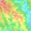
Asciano topographic map

Click on the map to display elevation.

About this map

Name: Asciano topographic map, elevation, terrain.

Location: Asciano, Siena, Tuscany, 53041, Italy (43.15377 11.37891 43.32402 11.67293)

Average elevation: 285 m

Minimum elevation: 140 m

Maximum elevation: 640 m

Other topographic maps

Click on a map to view its topography, its elevation and its terrain.

Chiusure

Italy > Tuscany > Siena

Average elevation: 284 m

Bagni San Filippo

Italy > Tuscany > Siena

Average elevation: 594 m

Pievasciata

Italy > Tuscany > Siena > Castelnuovo Berardenga

Average elevation: 351 m

Gallina

Italy > Tuscany > Siena

Average elevation: 325 m

Modena

Italy > Tuscany > Siena > Sovicille > Recenza

Average elevation: 319 m

Ulignano

Italy > Tuscany > Siena > San Gimignano

Average elevation: 125 m

Bettolle

Italy > Tuscany > Siena > Sinalunga

Average elevation: 260 m

Vecciano

Italy > Tuscany > Siena > Piazze

Average elevation: 350 m

Cetinale

Italy > Tuscany > Siena > Ancaiano

Average elevation: 393 m

Lilliano

Italy > Tuscany > Siena

Average elevation: 285 m

Gear up for your next adventure:

⛺Camping Groundsheet - Protect your tent from moisture and dirt
🧴Bear Spray Holster - Quick-access carry for essential Canadian wilderness safety
🥾Hiking Boots - Sturdy boots providing ankle support and traction on rugged trails
🦯Trekking Poles - Reduced impact on joints for steep topographic climbs
💡LED Camping Lantern - Illuminate your campsite with long-lasting lanterns

As an Amazon Associate, this site earns from qualifying purchases at no extra cost to you.