Geolocate

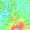
Chiusure topographic map

Click on the map to display elevation.

About this map

Name: Chiusure topographic map, elevation, terrain.

Location: Chiusure, Asciano, Siena, Tuscany, Italy (43.15596 11.53816 43.19596 11.57816)

Average elevation: 284 m

Minimum elevation: 172 m

Maximum elevation: 391 m

Other topographic maps

Click on a map to view its topography, its elevation and its terrain.
Siena

Italy > Tuscany > Siena

Average elevation: 251 m

Asciano

Italy > Tuscany > Siena

Average elevation: 285 m

Colle di Val d'Elsa

Italy > Tuscany > Siena

Average elevation: 250 m

Gaiole in Chianti

Italy > Tuscany > Siena

Average elevation: 433 m

San Casciano dei Bagni

Italy > Tuscany > Siena

Average elevation: 473 m

Castiglione d'Orcia

Italy > Tuscany > Siena

Average elevation: 472 m

Gear up for your next adventure:

🚑Survival Whistle - Signal for help across long distances in mountains
🧥Packable Rain Jacket - Breathable waterproof layer for unpredictable weather
🔭Compact Binoculars - Lightweight optics for scouting trails and wildlife
🧥Fleece Jacket - Warm and lightweight jacket for layering
🧊Portable Cooler - Keep food and drinks cold during outdoor adventures

As an Amazon Associate, this site earns from qualifying purchases at no extra cost to you.