Geolocate

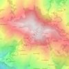
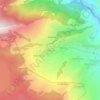
Surkhet topographic map

Click on the map to display elevation.

About this map

Name: Surkhet topographic map, elevation, terrain.

Location: Surkhet, Karnali Province, 21700, Nepal (28.33744 80.98092 28.97857 82.04042)

Average elevation: 958 m

Minimum elevation: 129 m

Maximum elevation: 4,387 m

Other topographic maps

Click on a map to view its topography, its elevation and its terrain.

Dandabada

Nepal > Karnali Province > Humla

Average elevation: 2,254 m

Bhalu Lek

Nepal > Karnali Province > Jajarkot

Average elevation: 4,871 m

Badalekh

Nepal > Karnali Province > Dailekh > Bestada

Average elevation: 1,513 m

Simikot

Nepal > Karnali Province > Humla

Lying at an altitude of just over 2,900 metres or 9,500 feet on a gentle slope high above the Humla Karnali River, Simikot lies on an ancient trade-cum-pilgrimage route to Mount Kailash. Mount Kailash is located in the Purang County of the Tibetan Autonomous Region, China, which borders Humla district of Nepal…

Average elevation: 3,100 m

Maddu

Nepal > Karnali Province > Dolpa

Average elevation: 2,473 m

Salle

Nepal > Karnali Province > Western Rukum District > Musikot

Average elevation: 1,537 m

Siladi

Nepal > Karnali Province > Dailekh

Average elevation: 1,401 m

Bheri River

Nepal > Karnali Province > Surkhet > Botechaur

Average elevation: 1,112 m

Thana

Nepal > Karnali Province > Kalikot

Average elevation: 1,526 m

Patihalne

Nepal > Karnali Province > Dailekh

Average elevation: 1,806 m

Guranse

Nepal > Karnali Province > Dailekh

Average elevation: 1,373 m

Chharka Bhot

Nepal > Karnali Province > Dolpa

Average elevation: 4,652 m

Chautara

Nepal > Karnali Province > Surkhet > Birendranagar

Average elevation: 1,197 m

Simikot

Nepal > Karnali Province > Humla

Lying at an altitude of just over 2,900m on a gentle slope high above the Humla Karnali River, Simikot lies on an ancient trade-cum-pilgrimage route to Mount Kailash. Mount Kailash is located in the Purang County of the Tibetan Autonomous Region, China, which borders Humla district of Nepal to the north. In…

Average elevation: 3,100 m
Jajarkot

Nepal > Karnali Province > Jajarkot

Average elevation: 1,205 m

Chandannath

Nepal > Karnali Province > Jumla

Average elevation: 2,749 m

Pokhra

Nepal > Karnali Province > Dailekh

Average elevation: 1,106 m

Burause

Nepal > Karnali Province > Jajarkot

Average elevation: 2,056 m

Gaighat

Nepal > Karnali Province > Surkhet

Average elevation: 545 m

Rara Lake

Nepal > Karnali Province > Mugu

Average elevation: 3,073 m

Kapurkot

Nepal > Karnali Province > Salyan

Average elevation: 1,446 m

Dho Tarap

Nepal > Karnali Province > Dolpa

Average elevation: 4,341 m

Manikapur

Nepal > Karnali Province > Surkhet

Average elevation: 673 m

Musikot

Nepal > Karnali Province > Western Rukum District

Average elevation: 1,474 m

Dapcha

Nepal > Karnali Province > Surkhet

Average elevation: 1,088 m

Simikot

Nepal > Karnali Province > Humla

Lying at an altitude of just over 2,900m on a gentle slope high above the Humla Karnali River, Simikot lies on an ancient trade-cum-pilgrimage route to Mount Kailash. Mount Kailash is located in the Purang County of the Tibetan Autonomous Region, China, which borders Humla district of Nepal to the north. In…

Average elevation: 3,100 m
Koli

Nepal > Karnali Province > Kalikot

Average elevation: 1,891 m

Musi Khola

Nepal > Karnali Province > Dolpa

Average elevation: 3,535 m

Kairang Khola

Nepal > Karnali Province > Humla

Average elevation: 4,186 m

Thinke

Nepal > Karnali Province > Kalikot

Average elevation: 2,118 m

Pratap Tole

Nepal > Karnali Province > Dolpa > Bhotgaun Kalika

Average elevation: 2,527 m

Mulpani

Nepal > Karnali Province > Surkhet

Average elevation: 654 m

Ghodesain

Nepal > Karnali Province > Dailekh

Average elevation: 1,432 m

Talituma

Nepal > Karnali Province > Mugu

Average elevation: 2,546 m

Nisalgaon

Nepal > Karnali Province > Dolpa

Average elevation: 4,126 m

Phalat

Nepal > Karnali Province > Jajarkot

Average elevation: 1,855 m

Japna

Nepal > Karnali Province > Jumla

Average elevation: 2,874 m

Ghari Mehelkuna

Nepal > Karnali Province > Surkhet

Average elevation: 563 m

tali rana

Nepal > Karnali Province > Jumla

Average elevation: 2,687 m

Phatagalna

Nepal > Karnali Province > Humla > Karkiwada

Average elevation: 2,880 m

Musikot

Nepal > Karnali Province > Western Rukum District

Average elevation: 1,474 m

Gear up for your next adventure:

🔦LED Flashlight - Powerful and long-lasting flashlight for camping and emergencies
🔥Emergency Fire Starter - Reliable ignition source for all weather conditions
🛌Down Sleeping Bag - Superior warmth-to-weight ratio for cold nights
🧣Evaporative Cooling Towel - Beat the heat during intense summer climbs
🥾Hiking Shorts - Breathable shorts suitable for summer hikes

As an Amazon Associate, this site earns from qualifying purchases at no extra cost to you.