Geolocate

Musi Khola topographic map

Click on the map to display elevation.

About this map

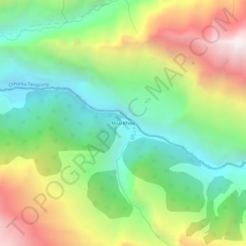
Name: Musi Khola topographic map, elevation, terrain.

Location: Musi Khola, Kaike-01, Kaike, Dolpa, Karnali Province, Nepal (28.86537 83.08143 28.90537 83.12143)

Average elevation: 3,535 m

Minimum elevation: 2,775 m

Maximum elevation: 4,734 m

Other topographic maps

Click on a map to view its topography, its elevation and its terrain.

Shey Phoksundo

Nepal > Karnali Province > Dolpa

Average elevation: 4,792 m

Kaike

Nepal > Karnali Province > Dolpa

Average elevation: 4,169 m

Gear up for your next adventure:

🩹Compact First Aid Kit - Pre-packed essentials for common trail injuries
🔨Vehicle Emergency Tool - Safety tool for remote road trips to trailheads
🔋Emergency Crank Radio - Weather alerts and power without needing batteries
🥾Light Hiking Boots - Lightweight and comfortable boots for day hikes
🛌Down Sleeping Bag - Superior warmth-to-weight ratio for cold nights

As an Amazon Associate, this site earns from qualifying purchases at no extra cost to you.