Geolocate

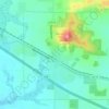
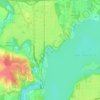
Mount Fuji topographic map

Click on the map to display elevation.

About this map

Name: Mount Fuji topographic map, elevation, terrain.

Location: Mount Fuji, Town of Colfax, Dunn County, Wisconsin, United States (44.94557 -91.77082 44.94567 -91.77072)

Average elevation: 313 m

Minimum elevation: 281 m

Maximum elevation: 376 m

Other topographic maps

Click on a map to view its topography, its elevation and its terrain.
Menomonie

United States > Wisconsin > Dunn County

Average elevation: 273 m

Colfax

United States > Wisconsin > Dunn County

Average elevation: 291 m

Knapp

United States > Wisconsin > Dunn County

Average elevation: 311 m

Menomonie

United States > Wisconsin > Dunn County

Average elevation: 274 m

Knapp

United States > Wisconsin > Dunn County

Average elevation: 311 m

Canary Island

United States > Wisconsin > Dunn County > Menomonie

Average elevation: 262 m

Ridgeland

United States > Wisconsin > Dunn County

Average elevation: 346 m

Gear up for your next adventure:

🧭GPS Tracker - Track your location in remote areas safely
🥾Waterproof Trail Shoes - Shoes designed to handle wet terrain
👟Trail Running Shoes - Agile footwear for fast-paced topographic exploration
🚲Heavy Duty Bike Lock - Secure your bike at the trailhead or during stops
🧭Orienteering Kit - Tools for map reading and navigation in the wild

As an Amazon Associate, this site earns from qualifying purchases at no extra cost to you.