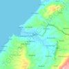
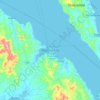
Negros topographic map
Click on the map to display elevation.
About this map

Name: Negros topographic map, elevation, terrain.
Location: Negros, Negros Island Region, Philippines (9.03808 122.37590 11.00300 123.56886)
Average elevation: 114 m
Minimum elevation: -2 m
Maximum elevation: 2,362 m
Other topographic maps
Click on a map to view its topography, its elevation and its terrain.
Baguio
In 1903, Filipinos, Japanese and Chinese workers were hired to build Kennon Road, the first road directly connecting Baguio with the lowlands of La Union and Pangasinan. Before this, the only road to Benguet was Naguilian Road, and it was largely a horse trail at higher elevations. Camp John Hay was…
Average elevation: 881 m
Quezon City
Founded as a pueblo by Saint Pedro Bautista in 1590, San Francisco del Monte may be considered Quezon City's oldest district. The original land area of the old town of San Francisco del Monte was approximately2.5 square kilometres (1.0 sq mi) and covered parts of what is currently known as Project 7 and 8 and…
Average elevation: 57 m
Bacolod
Bacólod (English: Bacolod), is derived from bakólod (Old Spelling: bacólod), the Old Hiligaynon (Old Ilonggo) (Old Spelling: Ylongo and Ilongo) word for a "hill, turtle, mound, rise, hillock, down, any small eminence or elevation", since the resettlement was founded on a stony, hilly area, now the barangay…
Average elevation: 49 m
Tubungan
Tubungan is 41 kilometres (25 mi) from Iloilo City. With a land area of 8,518 hectares (21,050 acres) found a hundred feet above sea level, the municipality's topography is dominated mostly by gentle rolling hills and idyllic mountains. The slope gradient ranges to as high as 25 per cent in most areas giving…
Average elevation: 153 m
Digos
Philippines > Davao del Sur > Digos
The land topography of Digos City ranges from hilly to mountainous in the north-northeast portion and flat and slightly rolling at the coastal barangays, while the urban area and the surrounding barangays in the south portion are generally flat. Generally, climate in Digos falls under the fourth type while…
Average elevation: 152 m

Taal Volcano
Philippines > Batangas > San Nicolas
Volcano Island sank from 1 to 3 m (3 to 10 ft) as a result of the eruption. It was also found that the southern shore of Lake Taal sank in elevation from the eruption. No evidences of lava could be discovered anywhere, nor have geologists been able to trace any visible records of a lava flow having occurred at…
Average elevation: 91 m
Trece Martires
The city of Trece Martires is characterised with ground elevation ranging from 30m to nearly 400m. Its ground slope ranges from 0.5 to 2%.
Average elevation: 150 m


Legazpi
Legazpi's topography is generally plain on the northeastern areas, with slopes ranging from five to fifteen degrees. The southern areas have mostly rolling to hilly terrain. In the city's coastal areas, the terrain varies from plain (north) to hilly (south). Legazpi is criss-crossed by several rivers including…
Average elevation: 150 m
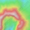
Mount Banahaw
Philippines > Quezon > Tayabas
The andesitic Banahaw volcanic complex is composed of several stratovolcanoes with Mount Banahaw, the largest with a maximum elevation of 2,170 metres (7,119 ft) above mean sea level. The summit is topped by a 1.5 by 3.5 kilometres (0.93 mi × 2.17 mi) and 210 metres (690 ft) deep crater that is breached on…
Average elevation: 1,730 m


Vigan
Vigan is situated in a Quaternary Age sedimentary plain called the Vigan-Bantay Plain which is part of the Ilocos coastal plain. The Vigan-Bantay Plain is bounded on the east by a moderately rugged Miocene sediments consisting of interbedded sandstones and shale to very rugged Meta-volcanics and Meta sediment…
Average elevation: 63 m

Kibungan
The municipality is within a cool highland mountainous zone with elevations at more than 2,500 metres (8,200 ft) above sea level. During its coolest months of December to January, Barangay Madaymen experiences chilling temperature of 0 °C (32 °F), causing the famous Frost of Madaymen.
Average elevation: 1,249 m




Mandaluyong
Another claims that the Spaniards named the place based on the report of a navigator named Acapulco, who saw the rolling hills frequently being lashed at by daluyong (“big waves from the sea”). This seems to confirm traditional pre-Hispanic stories that giant waves from the sea would meet the adjoining…
Average elevation: 33 m






Malolos
Malolos is relatively flat of about 0.81% to a gently sloping of 2.17%. The slope of the land descends towards west, southwest to southern direction. The highest land elevation is at about 6.0 meters above sea level while the lowest is only half a meter below sea level. A network of natural waterways and…
Average elevation: 6 m


San Juan
The topography of the town is characterized by hilly and mountainous terrain that gradually rises eastward from its coastal plains along the foothills of the Cordillera Central. The town is also traversed by several creeks and rivers, with the Baroro River being the most prominent.
Average elevation: 21 m




Surigao City
Philippines > Surigao Del Norte
Surigao City is marked by rolling hills that gently buffers its eastern and western boundaries. To the south-west towers the Kabangkaan Ridge which divides the city from the municipality of San Francisco (formerly Anao-aon). Kinabutan River (otherwise known as Surigao River) meanders Surigao valley before it…
Average elevation: 40 m
Antipolo
Its higher elevation than that of Metro Manila affords it a scenic view of the metropolis, especially at night. Its locally grown mangoes and cashews are popular among tourists, as well as suman – a local delicacy made out of glutinous rice. The Hinulugang Taktak National Park, which was once a popular…
Average elevation: 125 m
Mount Pinatubo
Even before the 1991 eruption, Mount Pinatubo had little topographic prominence: it was 1,745 m (5,725 ft) above sea level, only about 600 m (2,000 ft) above nearby plains, and only about 200 m (660 ft) higher than surrounding peaks, which largely obscured it from view. It is part of a chain of volcanoes which…
Average elevation: 1,047 m