Geolocate

Keat topographic map

Click on the map to display elevation.

About this map

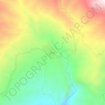
Name: Keat topographic map, elevation, terrain.

Location: Keat, Quirino, Cagayan Valley, Philippines (16.10659 121.37374 16.14659 121.41374)

Average elevation: 735 m

Minimum elevation: 366 m

Maximum elevation: 1,220 m

Other topographic maps

Click on a map to view its topography, its elevation and its terrain.

Maddela

Philippines > Quirino

Average elevation: 446 m

Cagayan River

Philippines > Quirino

Average elevation: 443 m

Addalam River

Philippines > Quirino

Average elevation: 456 m

Saguday

Philippines > Quirino

Average elevation: 112 m

Aglipay

Philippines > Quirino

Average elevation: 185 m

Cabarroguis

Philippines > Quirino

Average elevation: 296 m

Nagtipunan

Philippines > Quirino

Average elevation: 547 m

Diffun

Philippines > Quirino

Average elevation: 252 m

Maddela

Philippines > Quirino

Average elevation: 446 m

Gear up for your next adventure:

❄️Traction Ice Cleats - Slip-on spikes for icy trails and winter hiking
Camping Coffee Maker - Brew fresh coffee anywhere on the topographic map
🧢Beanie Hat - Keep your head warm in cold weather
🦯Trekking Poles - Reduced impact on joints for steep topographic climbs
🕯️Camping Lantern - Illuminates your entire campsite with high-efficiency LEDs

As an Amazon Associate, this site earns from qualifying purchases at no extra cost to you.